
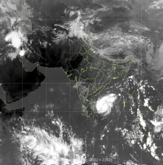
CYCLONE ‘MURASU’ FORMS OVER BAY OF BENGAL; LIKELY LANDFALL IN ANDHRA PRADESH BY NOVEMBER 3, ODISHA UNDER 3-DAY RAIN ALERT

Bhubaneswar: The India Meteorological Department (IMD) confirmed that the deep depression over the southwest and adjoining west-central Bay of Bengal has officially intensified into Cyclonic Storm ‘Murasu’. The storm system is moving west-northwestward at a speed of 23 km/h and is projected to strengthen further into a severe cyclonic storm.
According to the latest IMD weather tracking data, the cyclone’s trajectory has shifted slightly south. It is now expected to make landfall along the South Andhra Pradesh coast between Nellore and Narsapur during the midnight of November 2 to the early hours of November 3. The storm will carry sustained wind speeds of 100 to 110 km/h, gusting up to 120 km/h
While the primary landfall target is Andhra Pradesh, the Odisha government remains on high alert as the system is triggering a massive 3-day heavy rainfall warning across South Odisha districts. The state administration has already initiated evacuation protocols for residents in high-risk zones and low-lying coastal belts. Authorities are particularly focused on mitigating landslide risks in hilly terrains and waterlogging in urban spaces. Fishermen across both Andhra Pradesh and Odisha have been strictly ordered to return to shore immediately as sea conditions turn extremely rough